
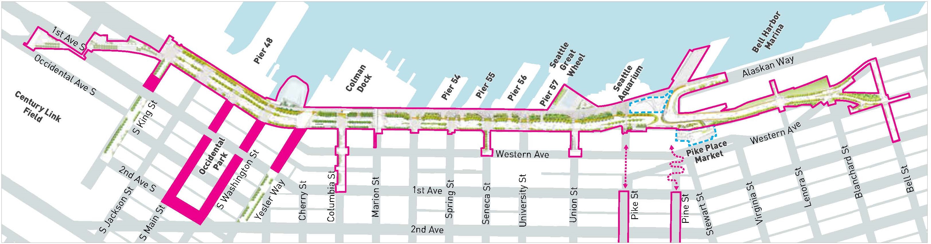
ABOUT THE PROJECT
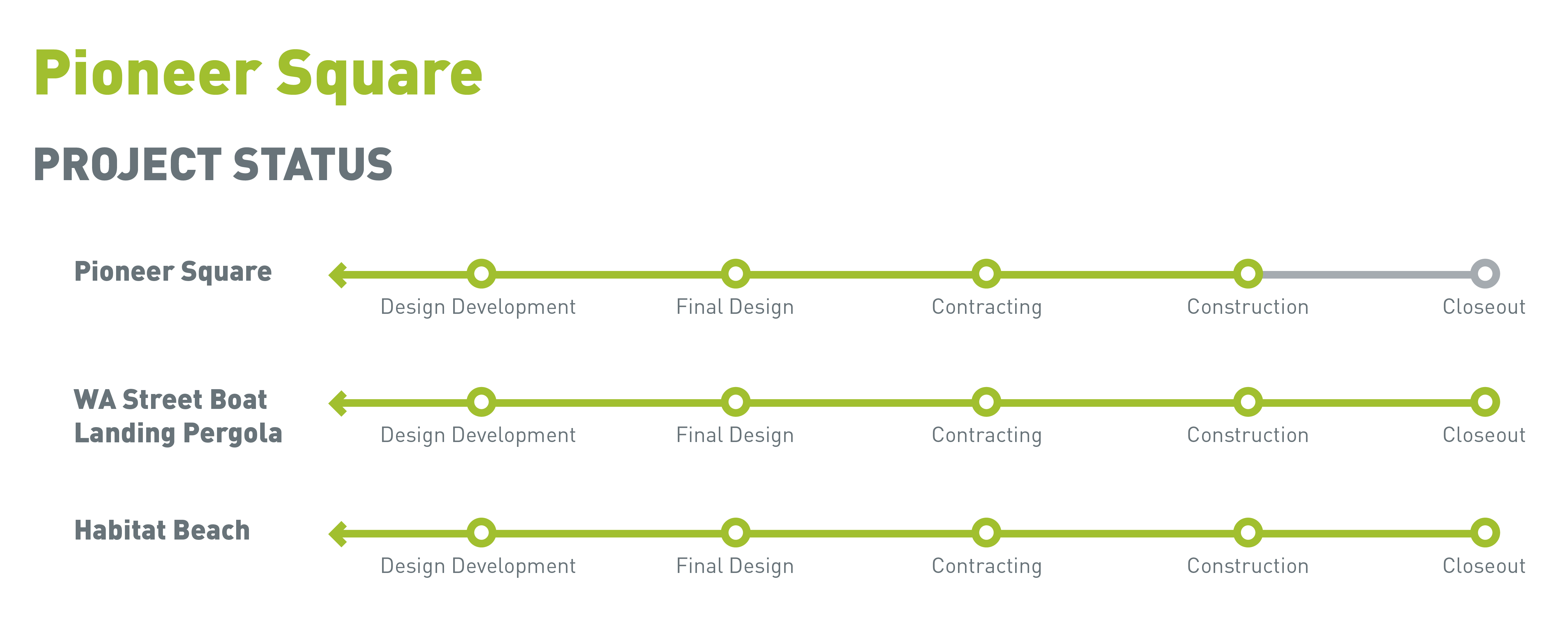
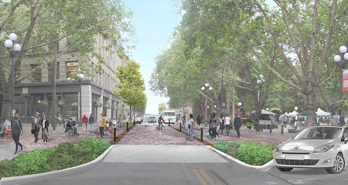
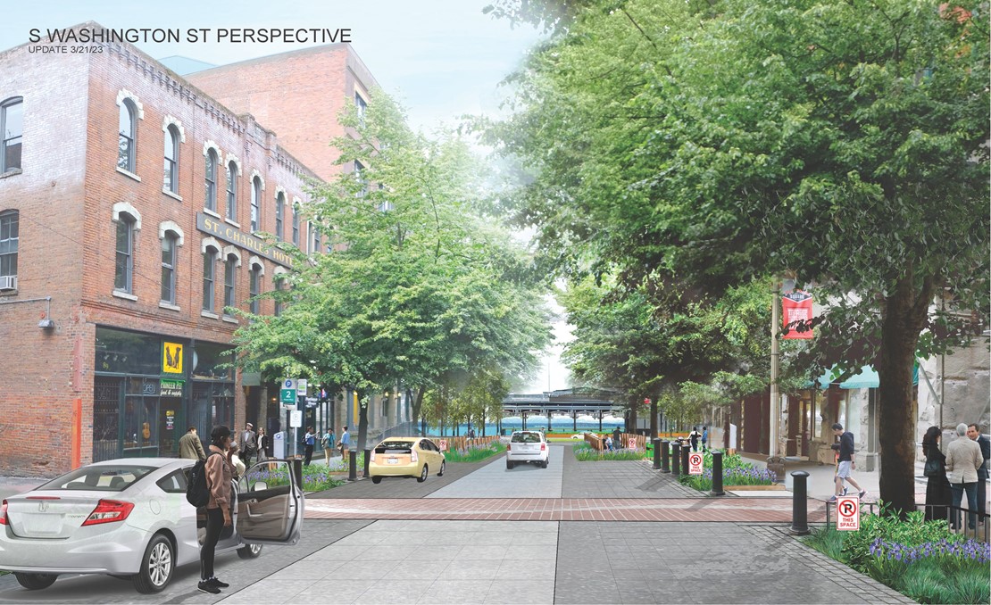
Pioneer Square East West Pedestrian Improvements
Working with community partner Alliance for Pioneer Square, we have designed and will construct improvements on portions of King, Main and Washington Streets, Yesler Way and 2nd Avenue S to prioritize pedestrians, improve sidewalks and increase greenery. The project will also reduce the number of vehicle travel lanes and limit traffic flow directions on portions of these streets in order to move vehicles away from structurally vulnerable areaways and optimize traffic operations and circulation in the Pioneer Square area. This project aims to improve accessibility for people of all ages and abilities and provide safe, convenient and graceful pedestrian connections. We anticipate that construction of this project will begin in early 2024 and continue for approximately a year. Construction will begin on S Washington Street and S Main Street, between 1st Ave S and Alaskan Way S.
On September 17, 2020, we issued a Determination of Nonsignificance (DNS) for these improvements, supported by an Environmental Checklist, in accordance with the State Environmental Policy Act (SEPA).
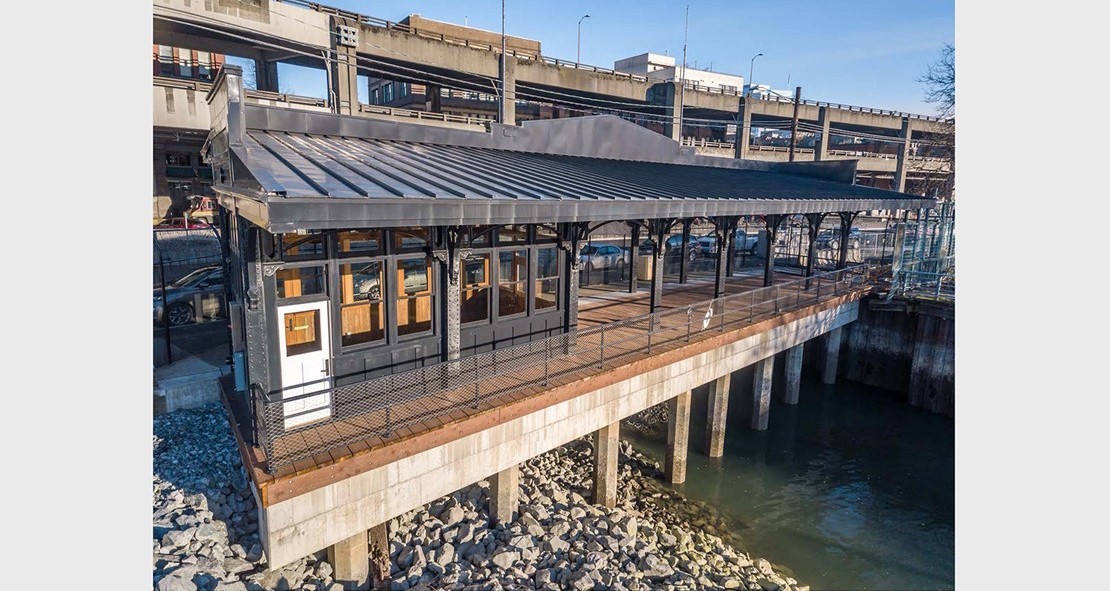
Washington Street Boat Landing Pergola
The Washington Street Boat Landing and Beach will restore access to the waterfront for Pioneer Square and the South Downtown community. The landmark pergola structure has been a piece of Seattle's waterfront since the early 20th century, and with its recent restoration, it once again serves as a symbolic gateway to the city from the Puget Sound. The pergola has been fully restored, but it will remain closed to the public until the park promenade has been constructed.

Habitat Beach is a national winner of the American Public Works Association's 2020 Project of the Year Award!
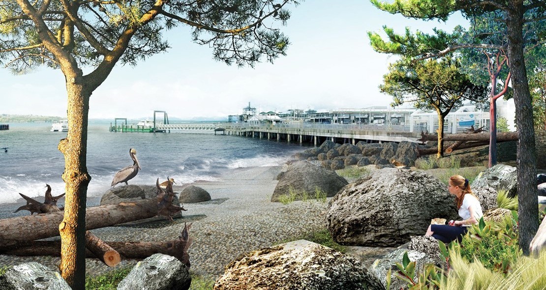
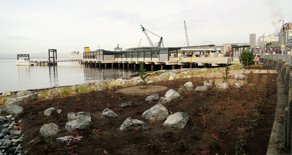
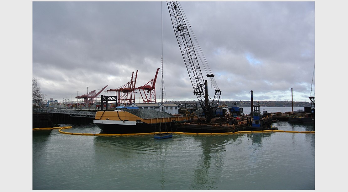
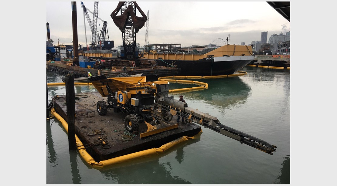
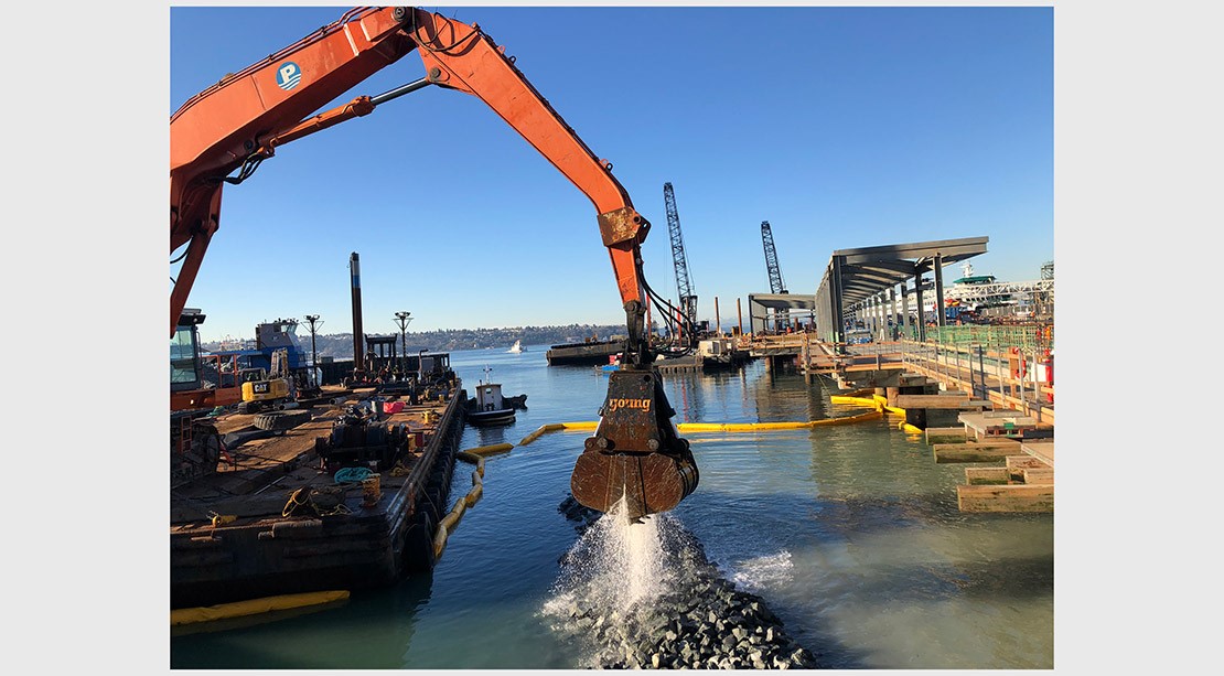
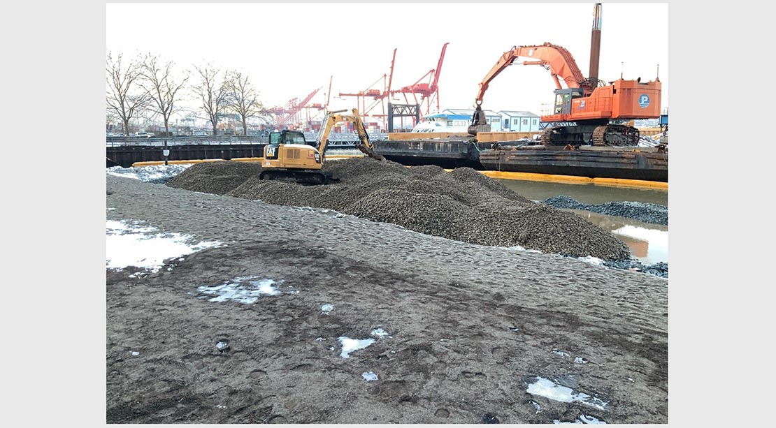
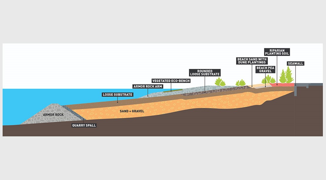
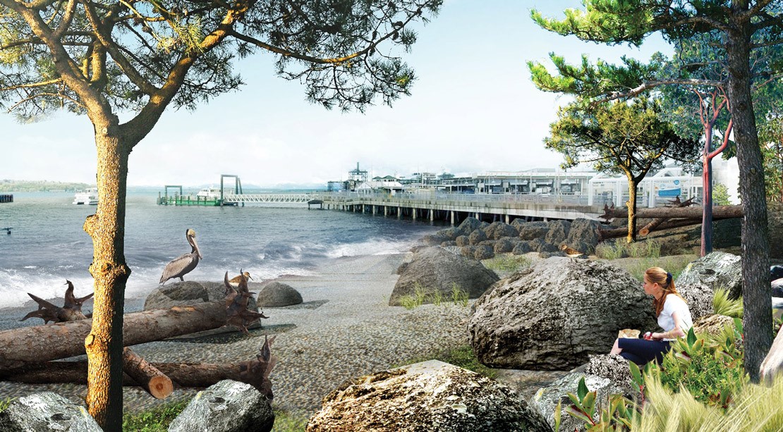
Pioneer Square Habitat Beach
Between Colman Dock and Pier 48, a new habitat beach supports the waterfront ecosystem, including enhancing the salmon corridor by adding rocks and nearshore vegetation. Improvements to the marine habitat began in October 2018 thanks to an agreement between Washington State Ferries and the City of Seattle to make these improvements on State-owned property. The plantings on the shoreline restore the function of a natural shoreline and improve ecosystem productivity. Check out this coloring page that explains the different layers that make up the beach.
The Pioneer Square Habitat Beach opened to the public on July 1, 2023. The beach is open every day from 7AM to 10 PM. Because the beach is a key component to Seattle’s nearshore marine habitat, some rules to keep in mind before heading down include no swimming or entering and exiting the water by personal watercraft, and packing out what you pack in. Additional rules and regulations can be found on the Friends of Waterfront Seattle website and are posted on-site.
![]()
How we've built it
Related documents
Pioneer Square East West Pedestrian Improvements materials
Construction materials
- April 2024 Pioneer Square Construction Flyer
- April 2024 S Washington St Tree Replacement Flyer
- December 2023 Pioneer Square Construction Flyer
Project fact sheet
- English December 2022 [PDF, 2.3 MB]
- Somali December 2022 [PDF, 3.8 PM]
- Español December 2022 [PDF, 2.4 MB]
- 简体中文 December 2022 [PDF, 2.6 MB]
Design materials
- Presentation to Pioneer Square Preservation Board July 2022 [PDF, 40.7 MB]
- Presentation to Pioneer Square Preservation Board November 2021 [PDF, 12.4 MB]
- Video about Pioneer Square pedestrian improvements (available with español, 简体中文 and Soomaali captions). April 2021
Design outreach
- Online Open House May 2021 [PDF, 2.6 MB]
- 60% design feedback summary May 2021 [PD,F 1.8 MB]
- Concept design feedback summary July 2019 [PDF, 3 MB]
- Project kick-off feedback summary April 2019 [PDF, 2.3 MB]
Environmental documents
- Determination of Nonsignificance September 14, 2020 [PDF, 89 MB]
- Environmental Checklist September 13, 2020 [PDF, 6.2 MB]
Pioneer Square Habitat Beach materials
- Pioneer Square Habitat Beach coloring page May 2019 [PDF, 523 KB]
Washington Street Boat Landing materials
- Washington Street Boat Landing construction videos
- Pergola restoration time-lapse December 22, 2017 [Youtube link]
- Pergola removal time-lapse February 13, 2014 [Youtube link]
- Washington Street Boat Landing Restoration project September 2016 [PDF, 5 MB]
- Washington Street Boat Landing project information
Washington Landings materials
- Revised Pre-Concept Plan, July 2022 [PDF, 10 MB]
- Revised Pre-Concept Plan, April 2021 [PDF, 2 MB]
- Design summary October 2015 [PDF, 22 MB]
- Informational displays June 3, 2015 open house [PDF, 11 MB]
- Presentation, March 2015 [PDF, 42 MB]
- Historic South Downtown website